
PENNSYLVANIA, USA — NOAA and the National Weather Service put out a winter outlook every year—a long-range forecast that encompasses December, January, and February, otherwise known as meteorological winter.
It looks at the 90-day average in terms of temperatures and all forms of precipitation, including rain, snow, sleet, and freezing rain. It is a conglomeration of all three months as an average compared to what is considered "normal."
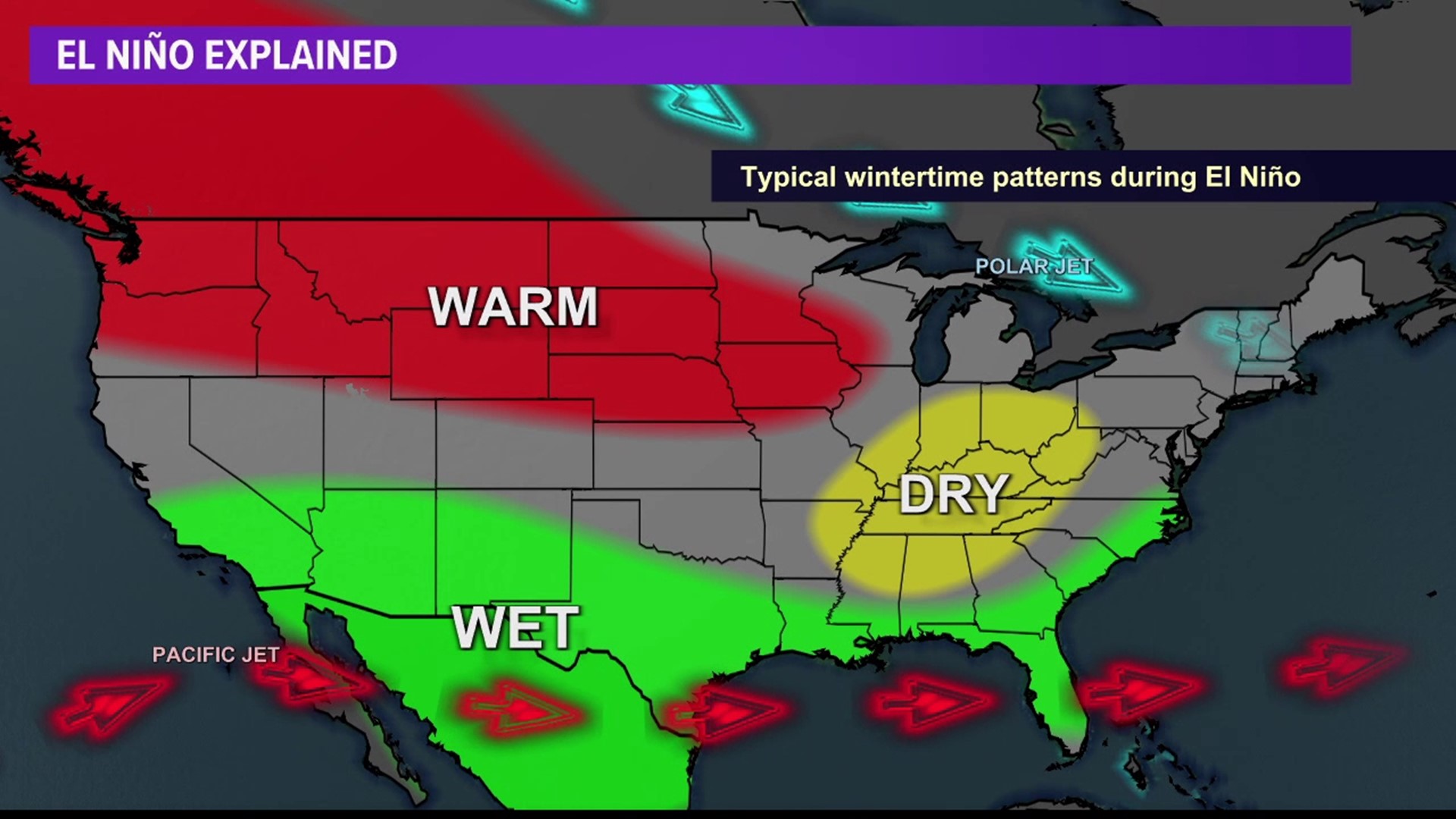
This winter, meteorologists predict El Niño will impact our weather.
El Niño and La Niña are two opposing climate patterns in the Pacific Ocean that can affect the weather worldwide.
Typically, trade winds, which blow east to west, push warm surface waters toward Asia. But El Niño and La Niña are phases that break these normal conditions, making the ocean temperatures warmer or colder than average.
Scientists call these patterns the ENSO cycle; it is just one factor affecting weather patterns.
The past three winters, we saw a La Niña weather pattern. Meteorologists say it is not unheard of, but it is an abnormality to be in the La Niña phase three winters in a row.
They call it a triple-dip pattern, and that was only the fifth time since record-keeping began.
But now, we have entered the El Niño phase. We will still see cold snaps, but the odds tilt in favor of Pennsylvania seeing above-average temperatures for the entire three-month period.
The precipitation outlook is where it gets interesting. Much of the state of Pennsylvania is seeing "equal chances" for above-average or below-average precipitation. But the far northwestern part of the state is seeing a below-average chance while the southeastern part of the state is seeing an above-average chance.
Here is why: El Niño-type winters tend to see a specific kind of storm. Storm systems ride up the eastern United States, and with these coastal-type storms or "Nor'easters," there is a very tight gradient for the haves and have-nots.
Therefore, how far east or west these storms track will largely determine how much precipitation we see. If they stay too far east, we won't see much of anything. But if they hug the coast, eastern Pennsylvania will be a sweet spot for seeing more snow.
We saw some of these coastal-type storms in the La Niña phase the past three winters. But La Niña tends to drive in lower-precipitation type systems from the Great Lakes, which we saw a lot of the past few winters.
There are other variables that impact winter weather, so it is important to remember that an El Niño phase does not provide an exact forecast, and therefore, the winter weather outlook is more of a general idea of what to expect these next three months.