With snow in the forecast this weekend, once again, it will be a unique storm offering a little bit of everything: rain to snow to falling temperatures to wind.
And with those changes throughout the duration of the storm, there will also be changes to the type of snow that is falling.
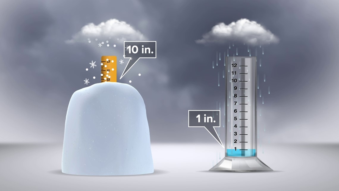
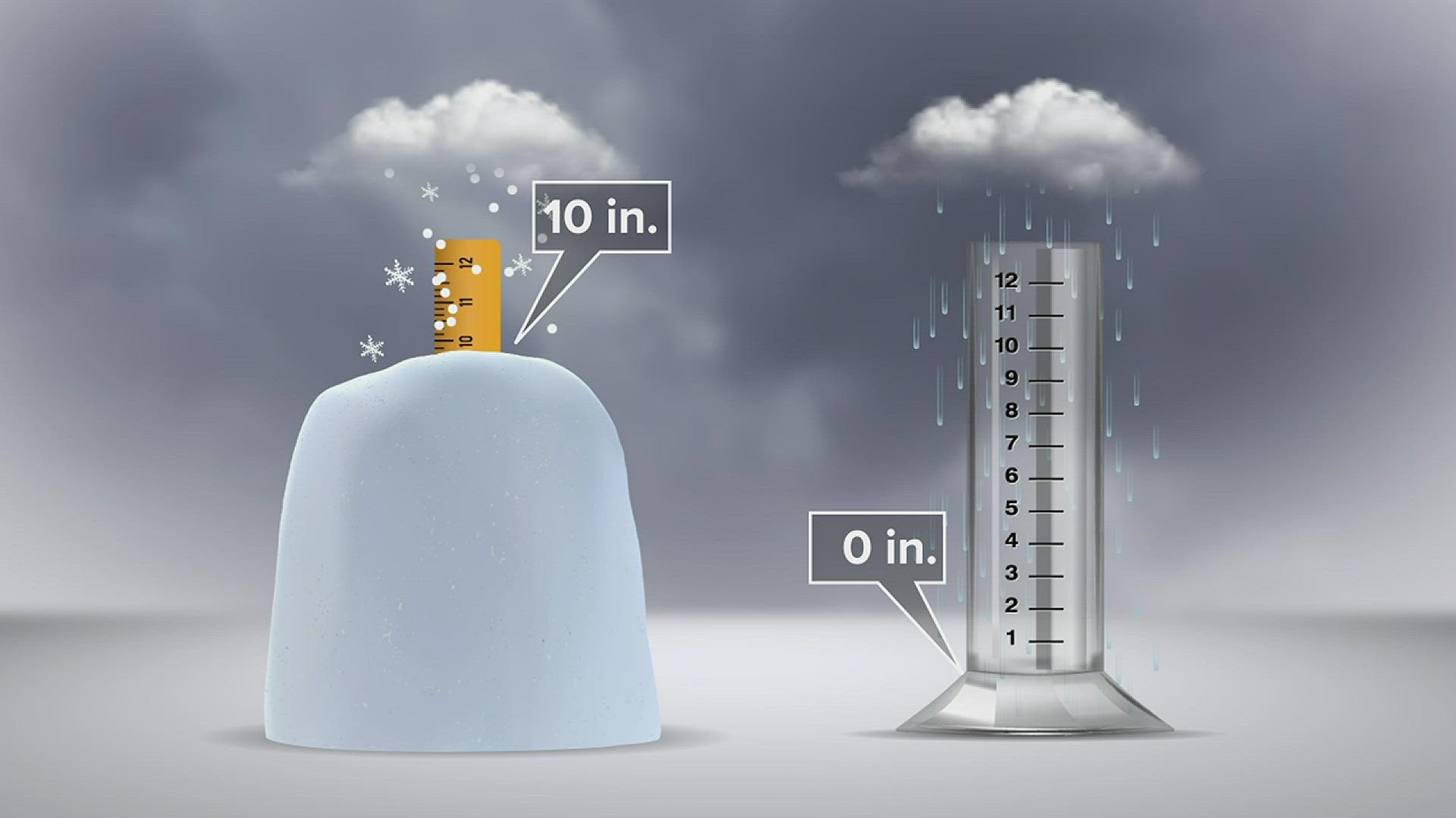
You have probably heard of the 10:1 snow to rain ratio. That means for every 10 inches of snow that falls, that is equal to one inch of liquid water or rain. That is a good general rule to follow, but it is actually a little more complicated than that. There are other factors that go into the snow to liquid equivalent, which will also impact snow totals.


When there is snow in the forecast, you will mostly likely hear us describe what kind of snow will fall. We might say the snow is going to be slushy, wet, and heavy, or we could say it is going to be dry, fluffy, and light. You have probably come to know, wet, heavy snow is hard to shovel but really good for making snowballs and snowmen.
Fluffy, light snow is much easier to shovel. But when it is windy, dry snow can also be dangerous because it can blow and drift. So how do we know what type of snow to forecast?
When the temperature is right around 30 degrees, we can use that general 10:1 snow to rain ratio. That means if we got 10 inches of snow in the WNEP backyard melted down, it would be one inch of liquid in the rain gauge.
If the temperature is warmer, like in the low and mid-30s, the ratio will be lower. So if the ratio is 5:1, that means that same inch of water in the rain gauge would only be 5 inches of snow instead of 10 inches like in the last example. That is a lot less snow on the ground, even though the amount of liquid equivalent is actually the same.
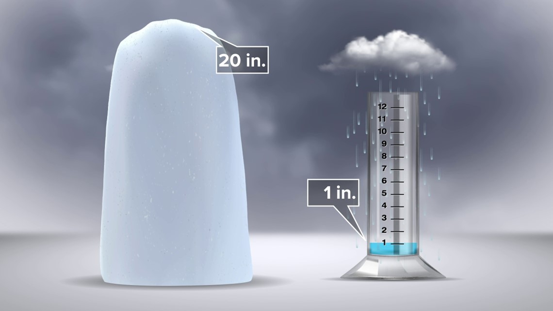
On the other hand, when the temperature is well below freezing, like in the 20s, we will have a much higher snow ratio, like 20:1, or it can even be 30:1. With much colder temperatures and higher snow ratios, that same inch of water in the rain gauge could come out to be more than 20 inches of snow on the ground.


The meteorological reason for the two different types of snow has to do with the amount of moisture in the snowflakes. It really is true that no two snowflakes are the same. With warmer temperatures, the snow can melt slightly before it hits the ground, so that will add moisture to the snowflake, and it becomes more dense. When this type of snow is falling, it'll be those big heavy flakes. The flakes stick together more easily, which is why it is easier to make snowballs and snowmen in this type of snow.
In dry, cold air, fluffy snow is less dense, and these types of snowflakes do not stick together. That is why when the wind blows, this type of snow drifts, reducing visibility and sometimes even creates whiteout conditions.
This weekend, the storm is expected to start as rain, then the changeover to snow happening towards Saturday morning. At first, the temperature Saturday morning will be right around the freezing mark; that means the snow will be wet and heavy at first. But quickly Saturday afternoon, temperatures will fall into the 20s. Then, you will notice the snow that is falling will be drier and fluffier. At that time, we are also forecasting the winds to really pick up, with gusts over 40 mph possible. Drifting and blowing snow will become a concern by the afternoon and evening on Saturday.
Temperatures then fall into the teens Saturday night, so anything wet or untreated will freeze.
For the latest on this weekend's storm, get the latest Stormtracker 16 forecast here.
CLICK HERE to see more of Ally's winter weather tips.
Check out severe weather tips on WNEP’s YouTube channel.


