PENNSYLVANIA, USA — Overview:

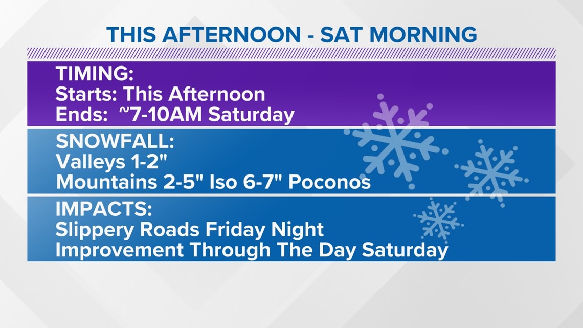
Our storm system has arrived producing mainly snow. Snow has varied in intensity Friday evening into Friday night. Snow continues in Northeastern PA into Saturday morning, tapering off by 10 AM. Road conditions will be slippery Friday night, especially in the mountains where it's colder and the snow will have an easier time sticking. Any areas that fall below freezing overnight will have patches of slick spots on roadways. Be careful.
Weather Alerts:

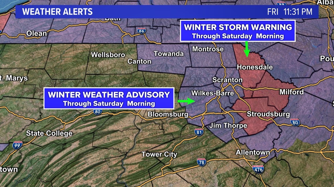
The National Weather Service has issued a Winter Weather Advisory for the Northern Tier and the Wyoming Valley through Saturday morning. There's a Winter Storm Warning for Wayne, Pike, and Monroe counties until Saturday morning.
Snow Forecast:


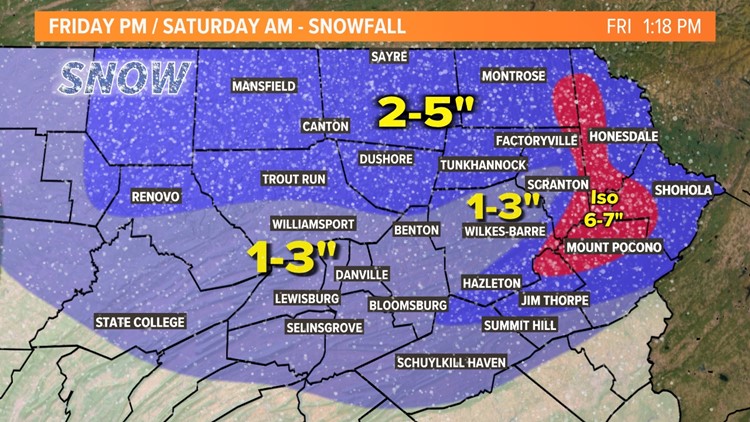
This will be another elevation dependent event. Snow will have a hard time sticking in the valleys with temperatures hovering just above freezing for most on the event. It will be colder in the mountains so you will see more snow there. Isolated 6-7" totals are possible in the higher elevations of Wayne, Pike, and Monroe counties.
What's Next:

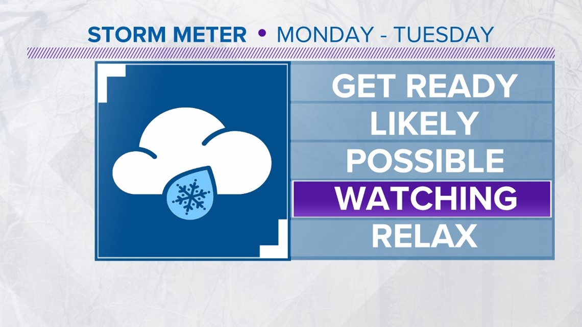
We don't get much of a reprieve before our next storm system appears. This would be a coastal storm.

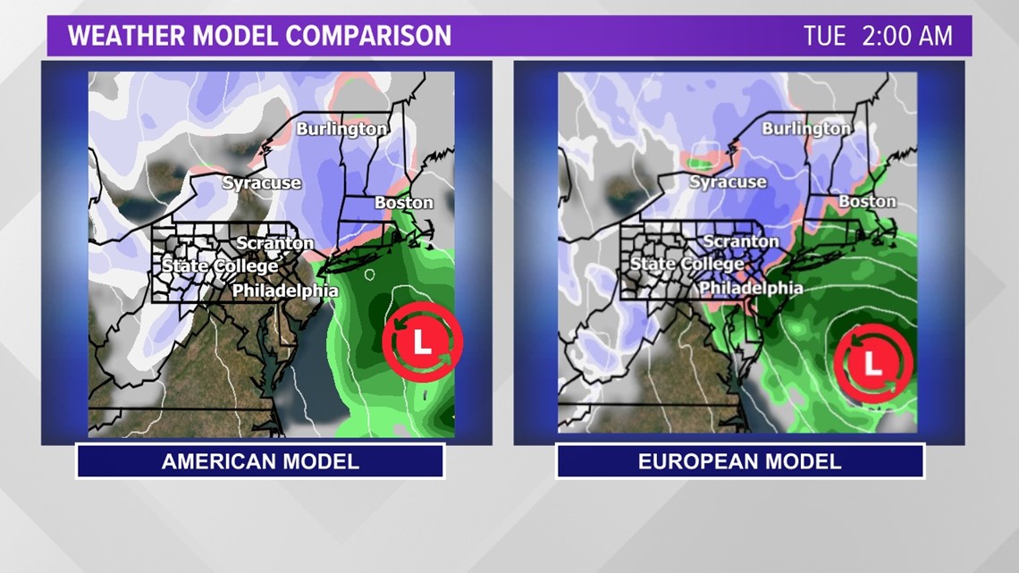
Model agreement isn't ideal for this potential coastal storm. Given that it's still several days away, we'll keep an eye on things and keep you updated on it through the weekend. While it's too early for specifics, this has the potential to be a rather hefty storm for the Poconos.