
DELAWARE WATER GAP, Pa. — The Poconos saw some of the highest rainfall totals on Thursday, and the Delaware River is expected to crest above flood stage in some spots Friday night.
Floodwaters are not expected to reach homes or businesses, but the river is having an impact on the Delaware Water Gap National Recreation Area.
Route 611 in the park was closed for some time as crews cleared the roadway of debris.
River Road in Smithfield and Middle Smithfield Township was no different.
In Pike County, Route 209 was down to one lane because of river erosion.
It was all hands on deck as crews worked to clear roads.
"They're out there with heavy equipment, cleaning mud and debris off some of the roads. They are cleaning up downed trees, you know, just unclogging culverts, making sure the drainage is flowing, and so they're out there all over the park today trying to take care of all of those things, just to make sure that we can keep our roads and everything open," said Kathleen Sandt, the public affairs specialist for the National Park Service.
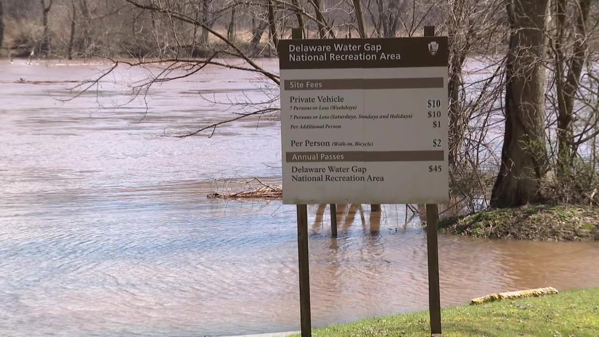
Sandt says the river is normally at five to six feet this time of year, but with all the rain, it was up around 19 feet. Some spots along the river are expected to crest just over flood stage.
"Especially here because we have so many steep slopes and we have so many hills, and we're in a valley, and so you know all of the water in the area is making its way towards the Delaware River before it can head to the ocean."
Park officials say nearly all the access points to the river are closed because they are flooded out.
"That doesn't really affect a whole lot of people this time of year because it's still a little cold. We're not seeing a lot of paddlers out there, but it does affect anglers who might want to be getting out on the river or getting near the river this year."
Park officials say the river is expected to crest around 21 feet at 8 p.m. Friday.
Rangers say they will reopen access points when the river drops below 15 feet.
Check out severe weather tips on WNEP’s YouTube channel.