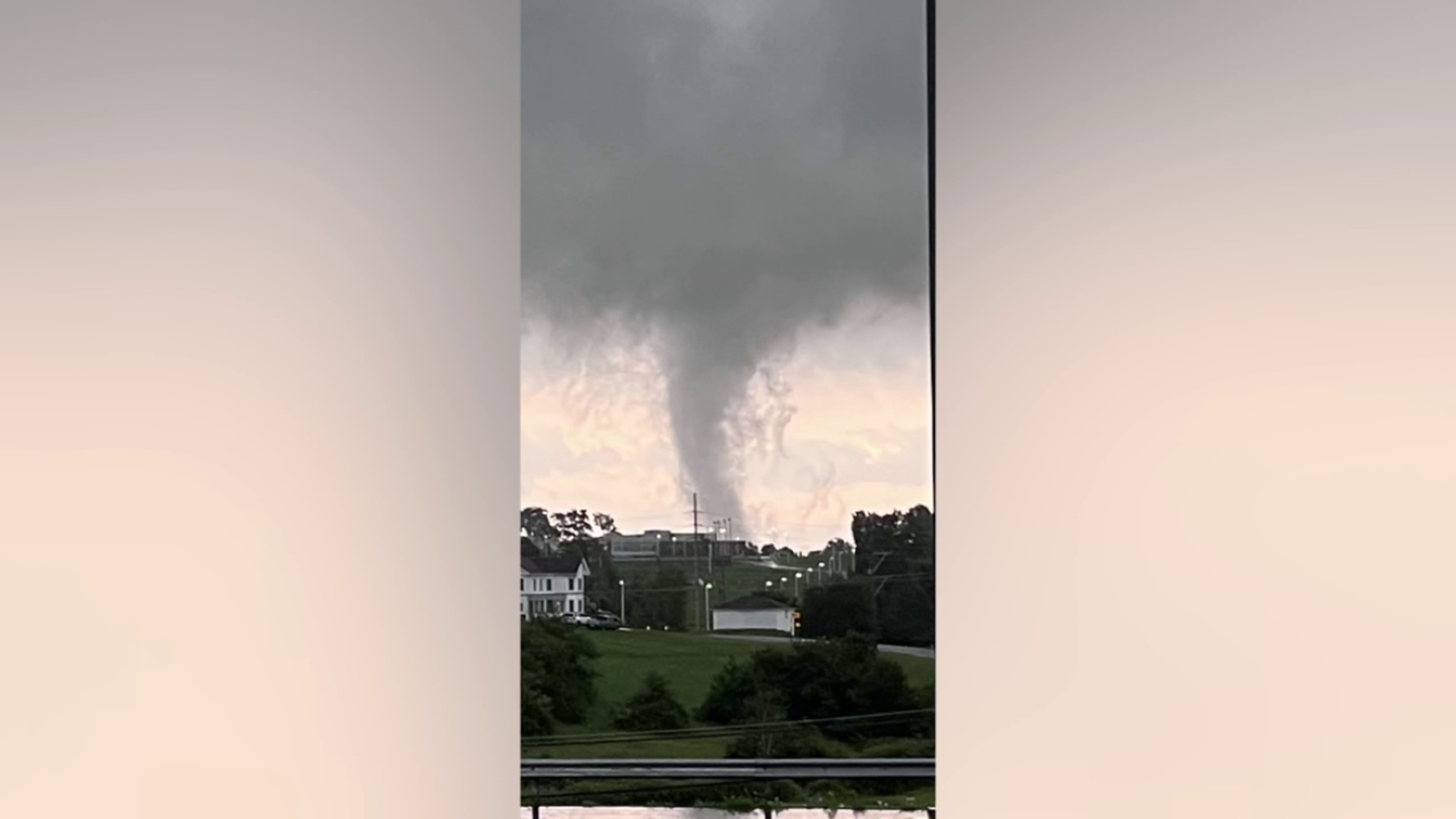
BACK MOUNTAIN, Pa. — To the untrained eye, this picture shared on social media by Griffin Corcoran appears to show a tornado right over Dallas High School.
It sparked concern for people who spend a lot of time outside in this part of Dallas Township.
"My nine-year-old son's like, 'Mom! A tornado touched down at the school!'" said Dallas girl's soccer coach Nikki Pekarski. "I'm like, 'that's not true.' And then I get that message and I'm like, 'Oh my gosh, you were telling the truth'."
"I was thinking that that could be real and that could really be do some damage to the schools and luckily there's no no no one, no one in it. So no one could get hurt," said Abby Blaker of Harveys Lake after getting some practice at the school.
Others knew better than to judge this cloud-based solely on its shape.
"When my mom showed me I was like, 'There's no way that's real'." said Jackson Tarantini.
Stormtracker 16 Chief Meteorologist Kurt Aaron says Jackson Taratini is partly right while this IS a real cloud, it is NOT a twister.
"What you see is you see an area of moisture that is getting caught in what's known as the updraft going up into the storm after the storm has already left. Condensation happens and then you get these clouds that form up and down vertically rather than horizontally so they appear to be as though they're funnel clouds but they're not they're actually SCUDs - stratocumulus under deck clouds," explained Kurt.
He says the easiest way to tell this is a scud cloud is that there is no debris circling it.
If it was a tornado, Kurt says, "you would see things flying in the air, like small things like leaves and things like that."

