

‘Tis the season for changing leaves, falling temperatures, and the threat for coastal storms/Nor’easters. We already have our first candidate and it’s showing up in the weather maps for this. Before we get into that though… indulge me here for a moment while I go into a brief rant.
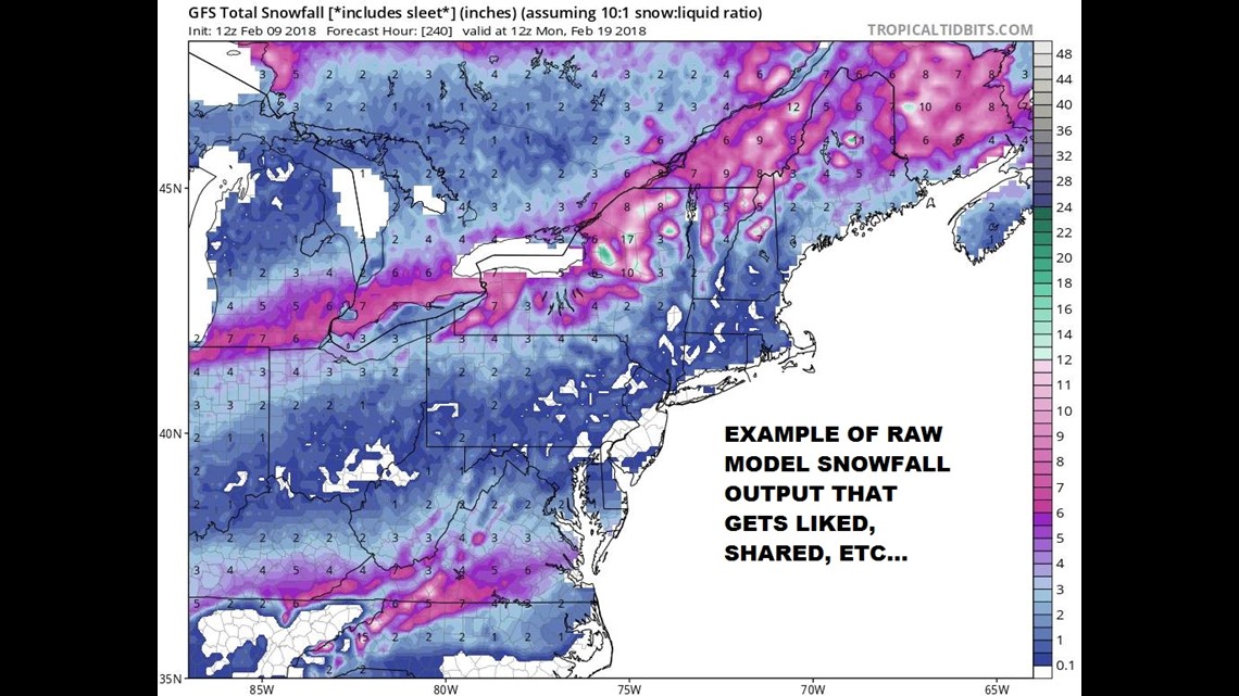
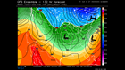
While it’s the season for Nor’easters, it’s also the season for raw model snowfall maps like the one above to get blindly shared, liked, Re-Tweeted, etc all around the social media world. You’ll see them along with some catchy headline like “BIG snowstorm possible in about two weeks. Like and share so your friends can see”. No… just no. This practice is just ridiculous and causes unnecessary panic. Just one example about what makes this practice insane is how weather models generate these maps. Fun fact – weather models cut the atmosphere into slices and depending upon the model’s physics scheme, it assumes that if just a handful of those slices are below freezing, then ALL the precipitation falling will accumulate as snow… completely ignoring other precip types like sleet and not accounting for the “fluff” factor that the snow might have. I could go on and on here… but I’ll just leave it at *think before you share*. What’s the source? Also – I’ll stand by my standard line of 1″ of snow in 10 minutes from a snow squall during the evening commute is of far more concern than 4″ of snow over 12 hours on a Saturday. It’s not ALL about the snow totals.
Onto the possible weekend storm….

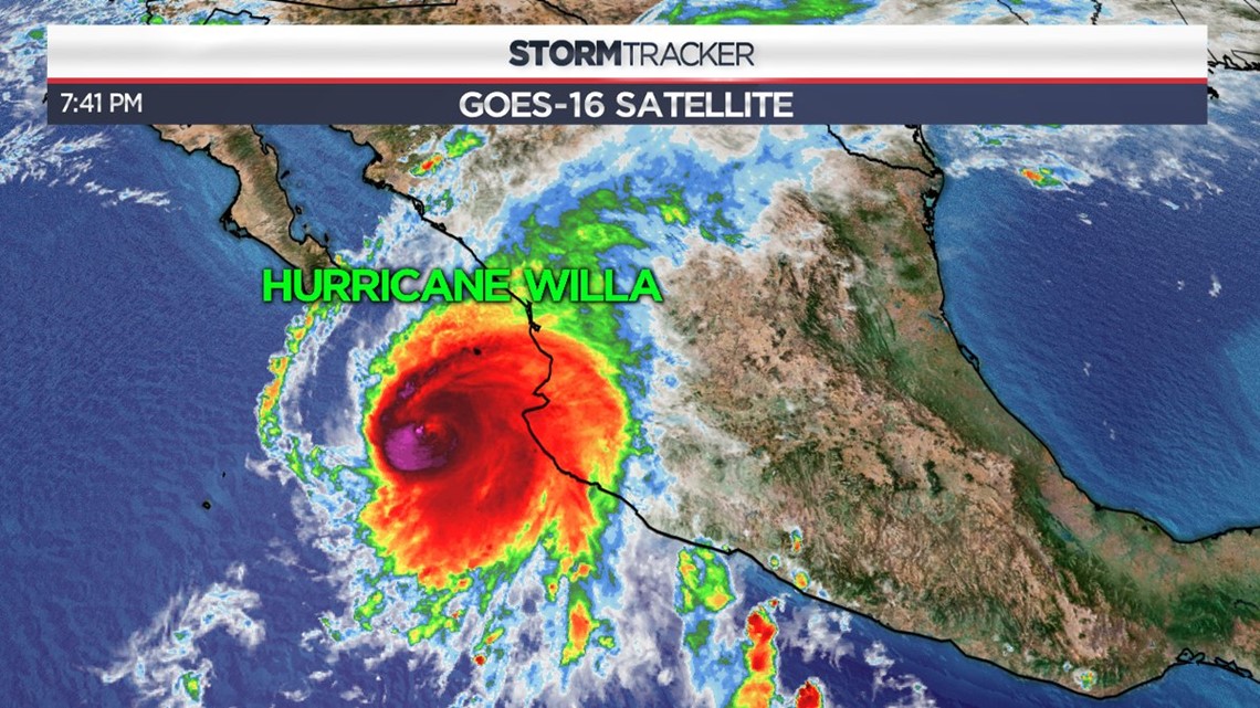
Believe it or not, the surface low pressure system that could ultimately become our weekend coastal storm is currently Hurricane Willa in the Pacific Ocean. Would be interesting if it brought two rounds of high impact weather over the course of its life cycle.
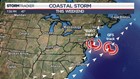
Basically there are two different camps right now. There’s the GFS camp which favors a more “out to sea” and lower impact scenario and there’s the EURO scenario (JMA also in this camp too) which pulls the surface low closer to the coast. A track closer to the coast obviously favors higher precipitation/wind impacts. The track of the low pressure system will largely be determined by what happens “upstream” from us.
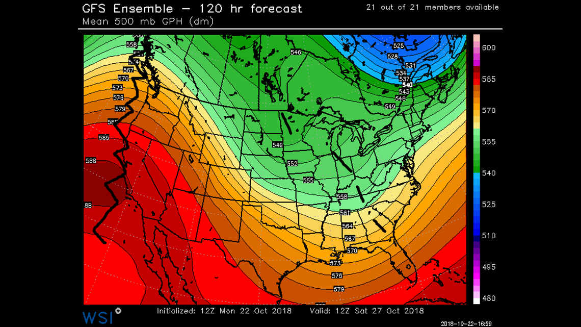
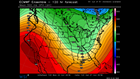
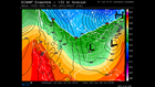
In the case of the GFS (out to sea) scenario, there’s a strong ridge along the West Coast, but note the disjointed nature of the downstream trough. In the Ensemble forecast for Saturday morning there’s a broad trough with several shortwave pieces of energy embedded within it. It’s less consolidated, weaker, and less likely to pull the storm closer to the coast.
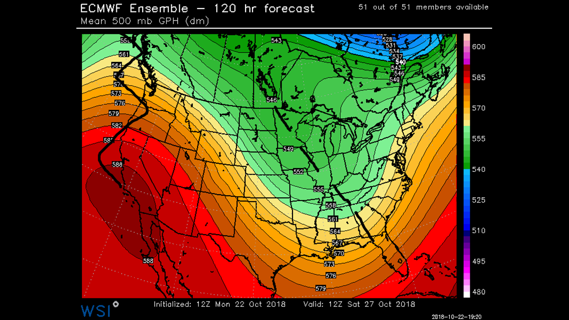
Meanwhile in the EURO Ensemble forecast for Saturday morning, notice that we still have the strong ridge along the West Coast, but the downstream trough is more consolidated. It also takes on a negative tilt which is helpful in pulling the low closer to the East Coast.
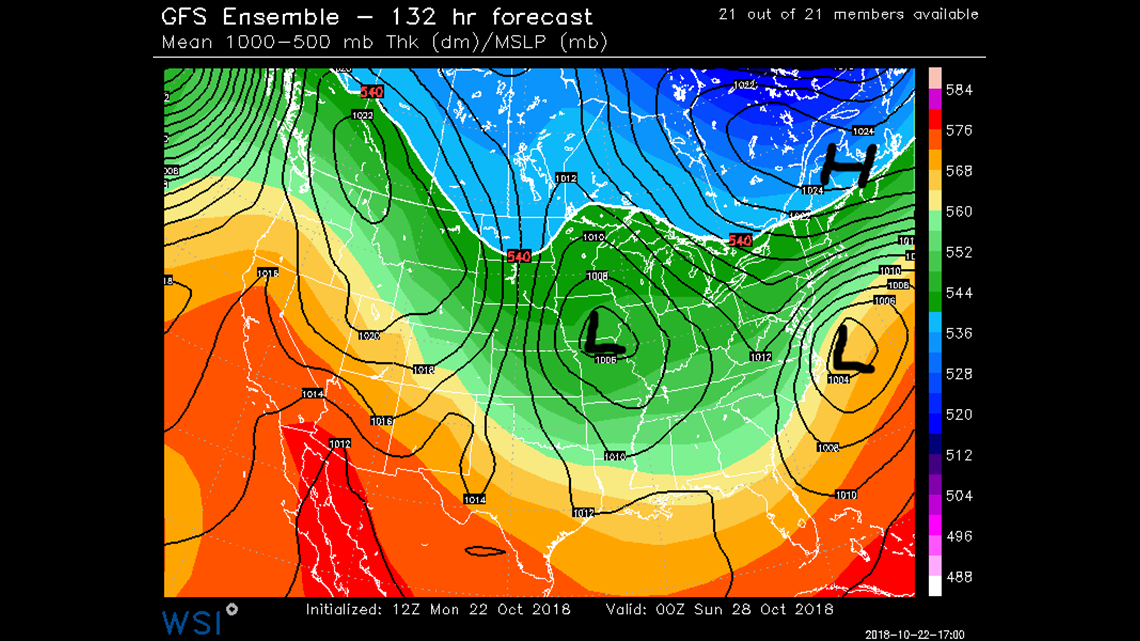
Here’s what the result of the differing upper level troughing features does to the surface systems. With the GFS, you have a weaker surface low off the coast and the high to the north is a bit more broad. The low in this case gets ejected out to sea. Outside of cloud cover and perhaps some passing showers, very little impacts would be felt locally.
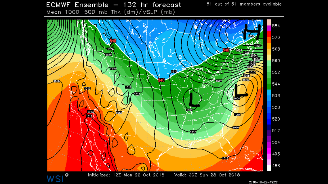
In the case of the EURO (and JMA), that high to the north is stronger, creating a strong pressure gradient between it and the coastal low. This scenario would help to “capture” the surface low and pull it into the coast with the potential for higher impacts.
What might those “higher impacts” be? At the very least, we’d have some wind and rain. Depending upon how much dry air could be fed in from that high to the north and how much cold air the system could “make” would ultimately determine if snow is on the table. At this point, I’d say even if there were to be snow, it would be confined to the higher elevations and not likely to create too many issues.
Obviously we have to be extra vigilant of snow this time of year because the trees are still fully leafed in most cases. Loading them up with heavy snow and adding wind to the mix would be a big problem.
Bottom line: it’s early, there’s a lot to watch, and if you have weekend plans like me, keep an eye on the forecast…. oh – and don’t share those silly model driven snowfall maps. 🙂
Stormtracker 16 Meteorologist John Hickey
Facebook: Meteorologist John Hickey WNEP
Twitter: @JohnWNEP