
The well advertised cooler (read seasonal) air is moving in Tuesday night. That much has been certain for quite some time now. What has remained more elusive is the answer to the question “will the colder air come with snow”? While there’s still no clear cut answer to that question, the long range weather maps started hinting at something today that I’d like to share.

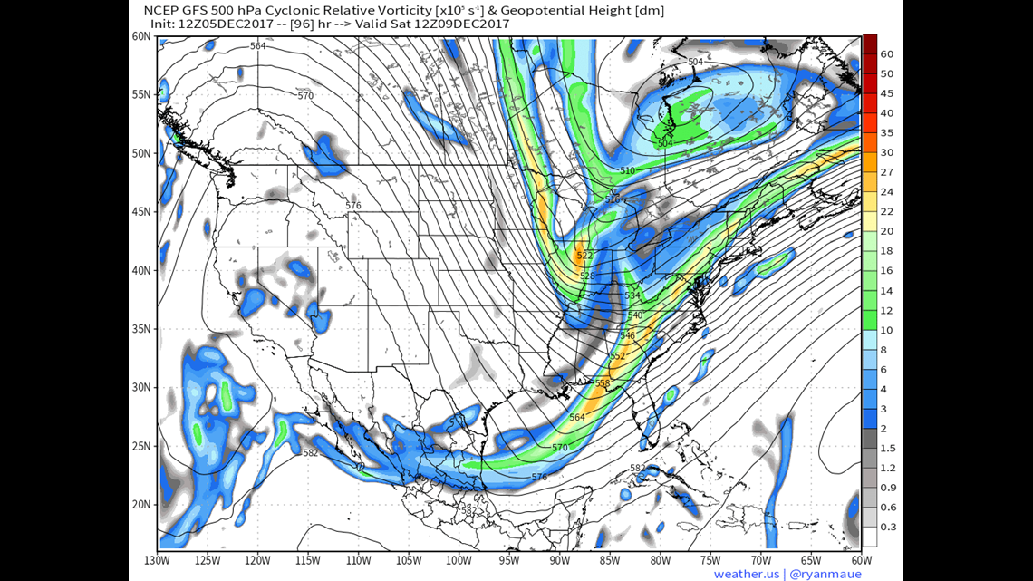
The image above shows jet stream level vorticity for this Saturday. Vorticity is a measure of spin or “energy” in the atmosphere. More spin = more energy. You also can see the ridges and trough across the Lower 48. As discussed in the last blog, us folks on the East Coast are in for a prolonged stretch underneath one of these troughs for an extended stretch. This will give us near to below average temperatures with at least the chance for some snow.
If you’re looking for a decent storm though, you’re not a fan of the pattern above. Notice how the East Coast trough is tilted to the right? This is called a “positive tilt” and generally deflects storms to our East and South. This essentially eliminates our chance at any kind of sizable storm this weekend. A little impulse moving out of Canada will pick up some Great Lake moisture and give us some nuisance snow… perhaps even enough for a first inch for those that haven’t seen it yet… but nothing to really write home about. However, there’s at least the *chance* that this changes sometime during the middle of next week.
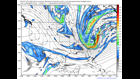
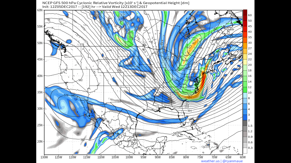
You’re looking at the same kind of map here as you were further above. The time frame pictured is Wednesday morning. Notice how the “cup” of the trough is more upright or even turned a little to the left? This is called a neutral… to slightly negative trough position. These are the kinds of setups that you’re looking for if you want a storm.

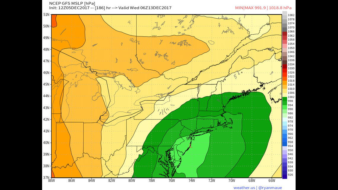
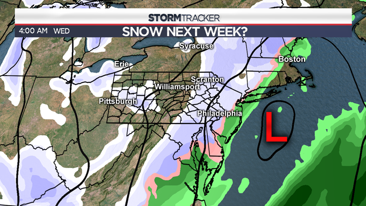
Right on cue, this particular model (GFS) shows a low pressure system along the Mid-Atlantic coast. In the spirit of transparency, this is from the morning run of this weather model. The subsequent afternoon run of the GFS model had that same system at least 300 miles further East. However, the overall setup does look consistent among several longer range models. An energetic jet stream will send down some spin from Canada and we’re likely to find some kind of wobble in the positioning of that East Coast trough. Will that wobble line up with a storm that impacts us? At this point, that’s really anyone’s guess. What I will say is that us snow lovers FINALLY have something to watch. This event WON’T be anything like last March even if it does pan out… but it would be a first decent storm of the season.
Stormtracker 16 Meteorologist John Hickey