
Our run with above average temperatures is about to come to a sudden ending. We’ve been talking about this change for more than a week now. In fact, I wrote a blog post about it a week ago. Well that change has finally arrived in the form of a fairly potent cold front.

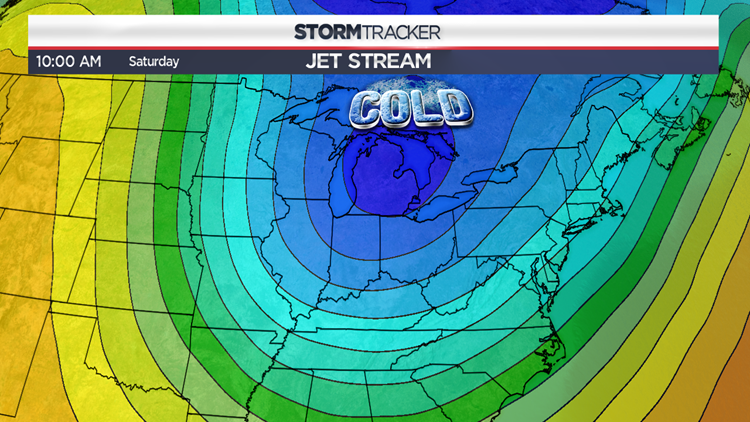
The map above roughly shows the height of the jet stream from Monday afternoon. Notice the ridge or warmth across the East. That has been a semi-permanent feature for much of the fall season. This ridge of warmth has also kept us rather dry. Meteorological fall (September, October, November) was the 13th driest in Northeast PA which is significant because data goes back more than 100 years! Well this cold front that comes through Tuesday into Wednesday will help to completely reorient the jet stream but will it help with the drought conditions?
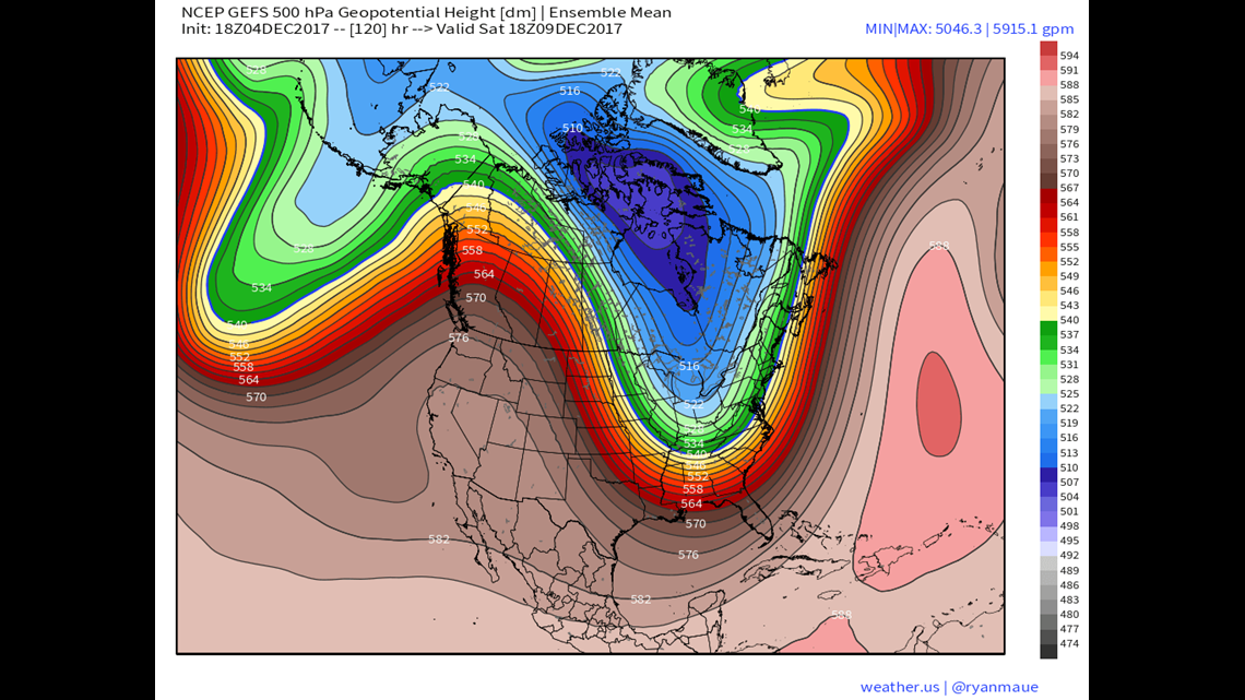
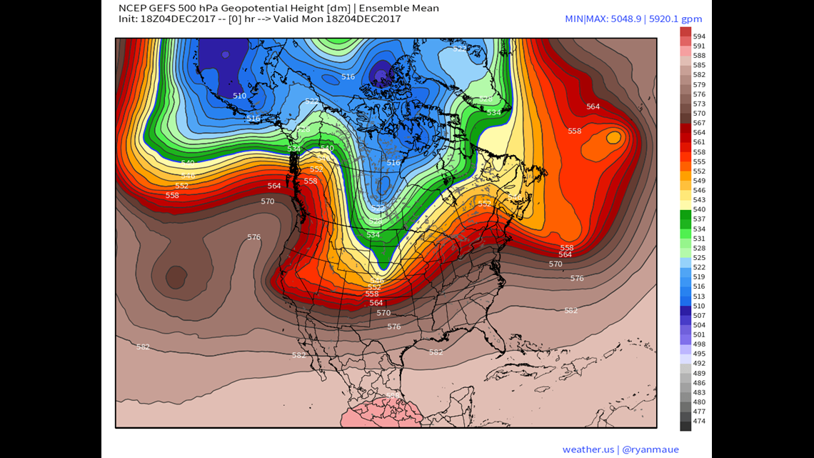
This map shows and ensemble model output of what the jet stream will look like by this weekend. Notice how amplified the pattern is with a huge ridge across the western US and the deep trough in the East. This type of pattern opens the door for much colder air to invade Pennsylvania, however, it’s not Arctic cold… though it may feel that way after our run of warmth. Sure – temperatures will be some 20 degrees colder compared to what we’ll experience early in the work week… but that just pushes us back to more typical early to mid December readings.
As far as drought busting storms go, I really don’t see it, but that doesn’t mean I don’t see at least the potential for some snow. The low hanging fruit here is the strong likelihood of Lake Effect snow for the typical Lake Effect snow belts of far western Pennsylvania and New York. Winter Storm Watches are in effect in those areas where 1-2 feet of snow is possible with the outside shot for 3 feet of snow in isolated areas by Friday morning. The stretch of warmth has kept the Great Lakes warm as well so these shots of cold air coming down out of Canada now will produce some significant Lake Effect snows until the Lakes cool significantly or freeze over.
Closer to home, our best chance for snow would be to get grazed by a coastal system this weekend. While we’re really not seeing much evidence in the forecast maps at the moment, the wild card in play is the source region of our air. Using that same highly amplified jet stream map above, you see a strong Northwest flow from Northwest Canada. This is a data sparse region which can lead to some “surprises” popping up on short notice in the forecast maps. It would only take one piece of energy that’s not currently being sampled well in the models to descend through the Great Lakes to alter the track of that coastal weekend system.
Regardless of snow potential – this change to colder, more seasonal air isn’t a brief thing. This weather pattern should hold for at least the next 10-14 days. While some natural snow would be great for the ski areas, at least the temperatures will be suitable for a serious snow making push going into Christmas week.
Stormtracker 16 Meteorologist John Hickey